Trail Commons Launches Open Mapping App for Mountain Bikers
Trail Commons has introduced a new mapping application designed to give users ownership of trail data for mountain biking across the US and Canada. This platform allows outdoor enthusiasts to discover, share, and contribute to a growing database of mountain bike trails, enhancing accessibility and community engagement.
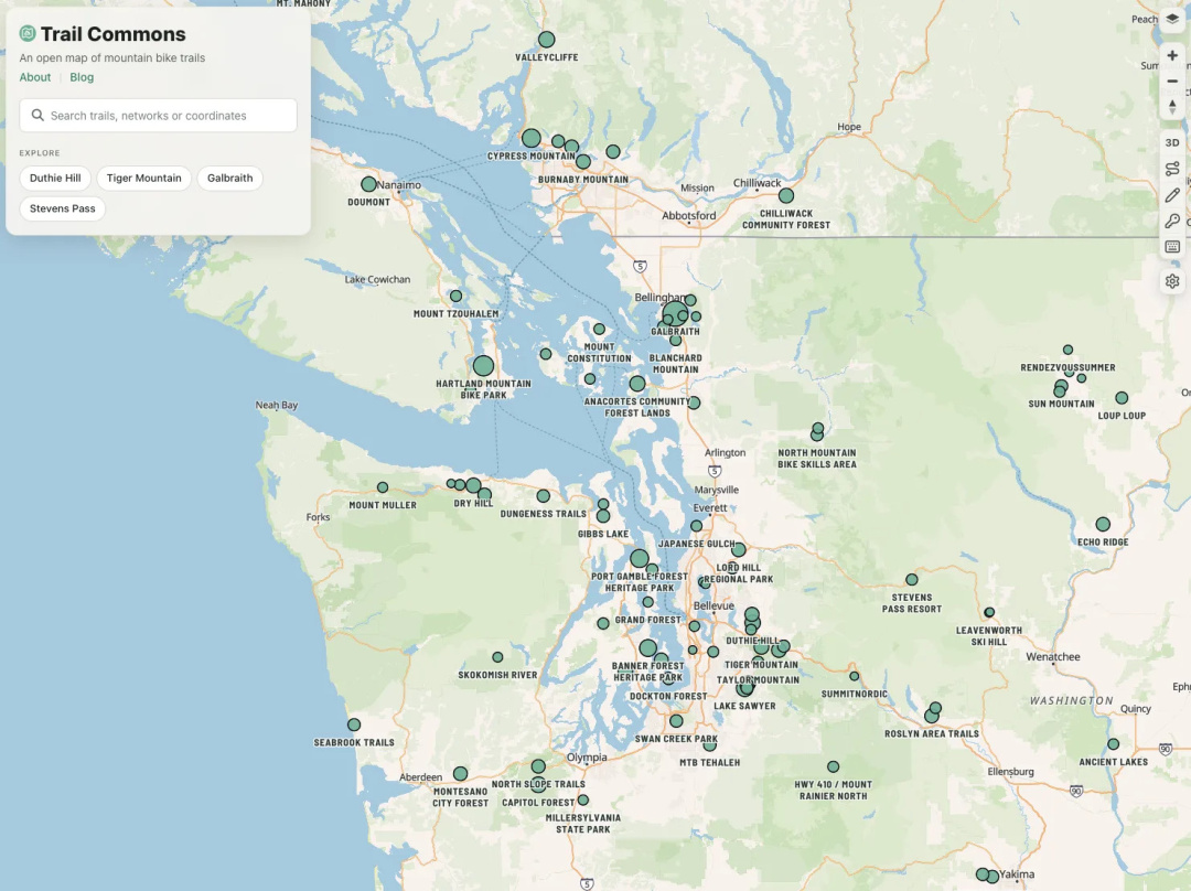
Trail Commons has officially launched a new mapping application aimed at empowering the public with ownership of trail data for mountain biking. This innovative platform focuses on mountain bike trails in the United States and Canada, providing a comprehensive database that is accessible under the Open Data Commons Open Database License. This initiative allows outdoor enthusiasts to copy, share, and build upon the data, fostering a collaborative environment for trail discovery and navigation.
The application leverages the existing framework of OpenStreetMap (OSM), which is also governed by the Open Database License. By utilizing OSM's trails and metadata, Trail Commons enhances the mapping experience with additional information such as trail descriptions, condition reports, and photographs. This rich dataset is designed to help users find and navigate trail networks more effectively. Future updates will include suggested routes to further assist riders in their adventures.
Users can easily contribute to the platform by logging in with their OpenStreetMap accounts. This feature allows them to edit trails, submit reports, and tag networks, making it a fun and engaging way to improve trail accessibility. The lightweight editor enables users to make adjustments to trail geometry and networks, ensuring that the information remains accurate and up-to-date. Contributions to the platform not only enhance the database but also help fellow mountain bikers by providing essential information about trail conditions and difficulties.
Features to Enhance Trail Exploration
The app offers several features designed to enhance the user experience. Riders can search for mountain bike trail networks in their area and discover new trails. Each trail network provides detailed information, including distances, elevations, and current conditions, along with photos to give riders a visual sense of the trail. Users can also get directions to the main trailhead of any network, making it easier to plan their outings.
Athlete Spotlights
In addition to these features, Trail Commons allows users to post trail reports directly from a trail's page, contributing to a community-driven approach to trail maintenance and information sharing. The platform also supports the display of lidar and aerial imagery, along with OSM GPS traces, to ensure accurate trail mapping and updates.
As the outdoor community continues to grow, Trail Commons aims to be a vital resource for mountain bikers looking to explore new trails and share their experiences. By providing open access to trail data, the platform not only enhances the biking experience but also fosters a sense of community among riders. Feedback from users is encouraged, as Trail Commons seeks to continually improve and adapt to the needs of the mountain biking community.